Thunderstorms are a common natural phenomenon, with an estimated 40,000 thunderstorms occurring worldwide every day. The United States, particularly the Southeast, experiences the highest frequency of thunderstorms due to its warm, moist air from the Gulf of Mexico and the Atlantic Ocean. For example, Florida experiences between 80 to 100 thunderstorm days annually. If you spend time outdoors, understanding thunderstorms and their dangers is crucial for your safety.
What Causes Thunderstorms and Lightning?
Thunderstorms form when three main elements come together: moisture, instability, and a lifting mechanism.
- Moisture: Typically originates from oceans or the atmosphere.
- Instability: Warm, moist air rises and cools, forming water vapor that condenses into cumulonimbus clouds.
- Lifting Mechanism: Air rises over mountains, or a cold front lifts warm air, initiating cloud formation and rainfall.
For example, thunderstorms are frequent in the Rocky Mountains during summer when clouds "lighten their load" by releasing rain.

Types of Thunderstorms
1. Ordinary Cell (Pulse Thunderstorm)
The ordinary cell consists of a single updraft (rising air) and downdraft (falling rain). As a cumulus cloud rises, water droplets become too heavy and fall as rain. These storms are typically short-lived but can produce hail, gusty winds, or even weak tornadoes. In extreme conditions, ordinary cells can create microbursts with winds up to 70 miles per hour.
2. Multi-Cell Cluster
Multi-cell thunderstorms consist of several ordinary cells grouped together. As one cloud ends its life cycle, others form, creating a continuous rainfall loop. New clouds often form upstream of the storm, but they can also form behind it, known as back-building storms. These storms can cause flash flooding due to heavy, sustained rainfall.
3. Squall Line
A squall line is a line of thunderstorms stretching for hundreds of miles. These storms can last for hours and are characterized by hail, high winds, and a constant cycle of new cloud formation on the storm's leading edge. Squall lines often follow a straight path and are sometimes called Derechos (Spanish for "straight"). Derechos can travel for hundreds of miles, causing significant damage and occasionally producing tornadoes.
4. Supercell Thunderstorm
Supercell thunderstorms are the most severe type. They consist of a single, powerful cell that can last for hours. Supercells are responsible for producing tornadoes, golf ball-sized hail, and winds exceeding 100 miles per hour. These storms are easily identified by their rotating clouds, which turn in a circular motion due to wind shear.
How to Stay Safe During Thunderstorms
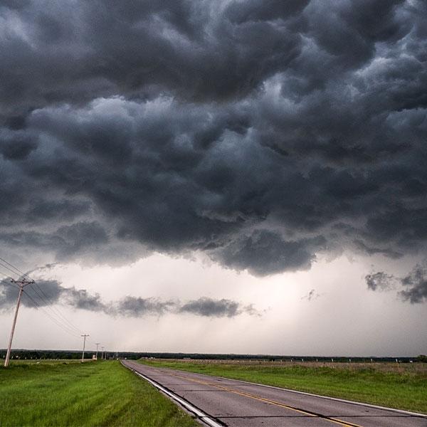
If you spot a storm cloud with the following characteristics, take cover immediately:
- A wall cloud lasting more than 10 minutes.
- Visible rotation within the cloud.
- Up-and-down motion of the cloud base.
Safety Tips:
- Find a sturdy building to shelter in place.
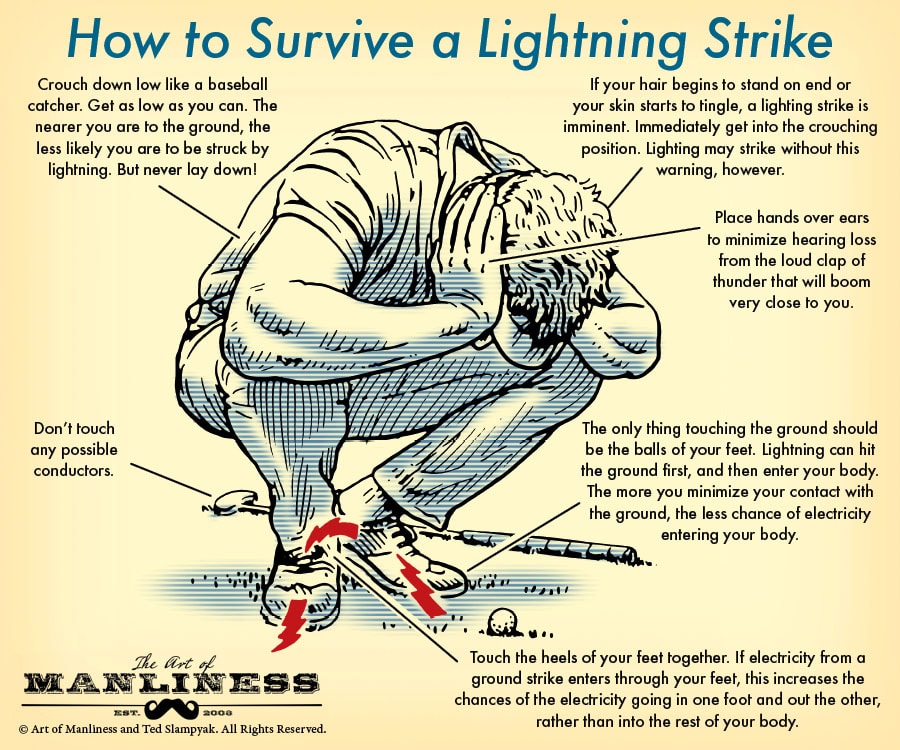
- If you cannot find shelter, crouch in a grove of trees (not under a single tree) or in a valley.
- Avoid being the tallest object in the area. Tuck into a low, compact position.
- Carry survival gear, including a blanket, fire starter, and hand warmers, as you may get wet and cold.
Conclusion
Thunderstorms can be unpredictable and dangerous, but understanding their causes and types can help you stay safe. Always monitor weather updates, recognize the warning signs of severe storms, and follow safety precautions to protect yourself and your loved ones.
Sources:


